The Only Time We’ve Ever Had Perfect Weather
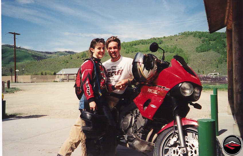
Some of the precursors to the trip were fantastic. First, Loretta flew in from New Jersey to spend her Memorial Day with us. She had landed on Thursday afternoon. I had taken the day off work and as soon as Kris got home, we decided to go shopping for a wedding dress for Loretta and Danny’s wedding in August. As most people realize, wedding dress shopping can be very tedious, but Loretta found the perfect dress right off the bat at the first store she went to. Definitely a good omen for the trip. (Not that we believe in omens… but it was still pretty cool).
Skip Ahead
- Day 1. Whats the Best Color
- Day 2. We have Orange, Red, Yellow and… Oh Yeah! Green!
- Day 3. The Trip Back Home
Whats the Best Color
Day One | 295 Miles
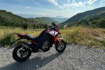
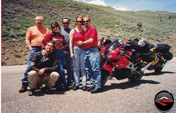
We started our trip through southern Utah on an early Saturday Morning. We had everyone meet over at our house around 7:30 am. Danny and Loretta had spent the night and Mark and Eric arrived early to have a nice big breakfast before we left. We figured that with it being Memorial Day we would have to leave pretty early to avoid all the RV’s and boats heading south to Moab and Lake Powell. However, the route we had planned would get us away from the majority of the traffic after only 50 miles or so.
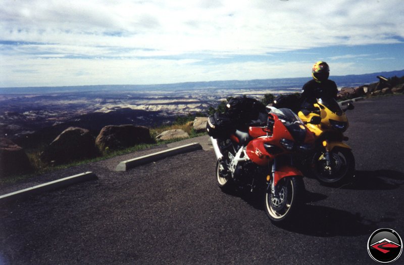
We blasted down I-15 towards American Fork, where we would take Hwy 6 towards Price. This canyon has been under construction for as long as I can remember, but this is the easiest way to aim us towards the best roads in Utah. As we made our way towards our next turn off it was a fight for survival against anxious holiday vacationers paying very little attention to their driving. Beware of Black Honda Accords b-lining it for Moab! The little black car tired to pass, but didn’t have the room, so they opted to split us up and pulled into the middle of the group of us. We slowed way down to allow the car to pass, but they never did. So we accelerated away from them and got out of their way before they tried to pass us again.
About half way to Price we turned south onto SR 96. This forgotten little road takes you past Scofield Reservoir and into the tiny town of Scofield (oddly enough). Scofield is an old mining town with one small gas station in the middle of town. After filling up and getting necessary snacks, we continued on our way. We continued to SR 264 then to SR 31. It all feels like one road when your on it, but on the map it says three different roads. Very strange.
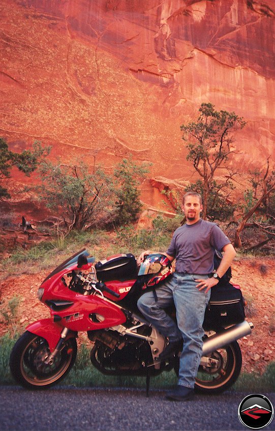
Here’s Danny and Loretta in front of the only Gas station in Scofield. This was the location of the best joke of the trip “Eric, we’ll have lunch later!” (Guess you had to be there).
This canyon wanders up the side of the mountain following the route of coal chutes from the ridge-line. When it nears the top it turns south and runs along the ridge. From this view you can see down into Sanpete County over the towns of Manti and Moroni. Then the road turns east and starts dropping in elevation. The vegetation changes from the high mountains to high desert then leaves you in Huntington. A town that feels so far from mountains that it is an eerie feeling to think you were just strafing a tight canyon. The diversity of Utah.
Again we stopped for gas then prepared for the long, straight part of the trip. This, we knew would be the low point of the trip, so we hit the road to conquer as quickly and painlessly as we could. The road, SR10, passes a huge powerplant It looms up out of the desert, then as quickly as it appears, it fades away into your mirror. It’s interesting how fast something so large can come and go in the desert. Just before we get to I-70, we stopped in the tiny town of Emery. Emery has the only gas station for a very long time. We stop, fill up, then continue on. Ten more miles of SR10 until we cross I-70 and things get very very fun.
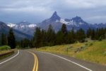
As we crossed I-70 the map showed the town of Freemont Junction. We have never seen this town of Freemont Junction. We assume that Freemont Junction is like the town of Brigadoon. It appears once every 100 years or so. Why else would it be on the map. But we don’t mind because Freemont Junction marks the beginning of one of the best roads in Utah. Highway 72! 72 is a magnificent road. The speed limit is marked at 40mph, but the openness and huge sweepers are a motorcyclists dream. It allows you to see several corners ahead and the remoteness of the road means there is rarely more than two or three cars during the entire 50-mile stretch allowing each of us to ride at whatever level we chose without much worry.
We had to stop at the top to savor the experience. The pavement is perfect, no gummy worms, and smooth pavement that is predictable and clear and free of road debris. Hwy 72 is a special road and one that requires good riding ability to really enjoy. Not because the road is too terribly difficult, but because it takes higher speeds to bring the road to life. As the road goes up and down hills, it makes huge sweeping switch-backs to the east and west, but before we got to the end of 72, we took the necessary detour. SR25 takes you up and around Fish Lake. I don’t many Utahn’s even know this road exists. It continues with the trend of 72 with the clean, predictable tarmac. Tires always grip well and confidence soars. Lean angles increase and the road makes you realize why Sport Touring is so great.On top we pass a series of Forest Service buildings, campgrounds and recreational areas. Oddly enough, there are only a very few people up here, making the views easy to enjoy without having to worry too much about traffic, which is literally, non-existant.
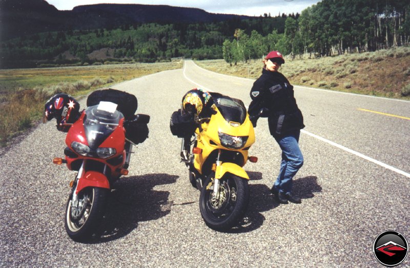
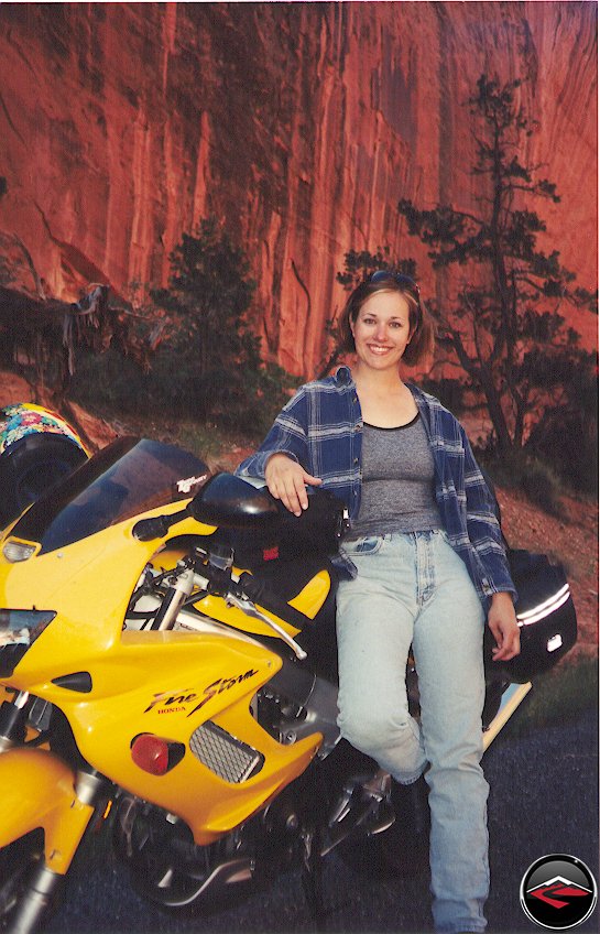
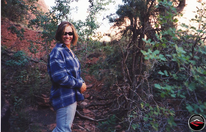
Here she is, Kris striking a pose on top of Red Fish lake road. (Look nobody around to see her be silly.)On the other end we dropped back down out of the mountains into the town of Loa. A Famous town with many songs written about it. (Loa- La La La Loa – Well I’m not the worlds most physical guy… and Loa, you got me on your knees, Loa. I’m beggin darlin’ please, Loa…).
Anyway, we continued on into Torrey. Torrey is one of my favorite towns in Utah, not only is it at the head of the Famous Highway 12, it is a very friendly community and has the best restaurant in Utah, "Cafe Diablo." Plus, right across the street, they have the friendliest campground I’ve ever been to. The first campground we stopped at was full. They have a swimming pool and lots of grass so we left feeling kind of bad. But the next campground on the road had a big sign that said "Bikers Welcome!" how can you ignore that. We stopped and while they were full too, they gave us a nice patch of grass real close (but not too close) to the restrooms.
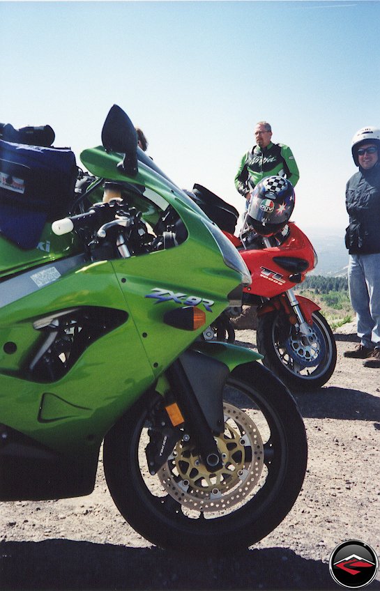
As we were getting ready to leave for dinner, the owner of the campground came rumbling around on his green Honda Four-wheeler. He stopped next to Eric on his vintage Honda CB and started asking him about it. Mark was quite distressed that no one noticed his bike and announced “But mine is GREEN!” Oh well, better luck next time Mark.
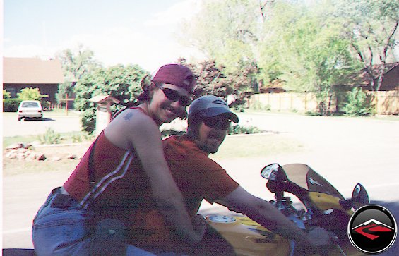
Bugs in our teeth, being irresponsible squids as we rode the two blocks to the restaurant. (Dave and Kris on the left – Danny and Loretta on the right.) Fortunately, the risk was not too great as we never exceeded 30 mph. It’s actually quite nice that Utah is a free state and allows us such indulgences. ( Utah does not require a helmet for motorcyclists over 18 years old. Check with local regulations before attempting.)We had a nice long dinner before we returned to the campground. Bikers from all over the country were camping here, and we were able to sit out, sip our drinks and enjoy stories of strange accidents, near misses, great roads, cool old bikes and exciting bikes yet to be released. It was a great time of camaraderie. A good time was had by all.
A super strong wind came up and started blowing hard from the west. The temperature got pretty chilly, Eric, Danny and Loretta were only using Tarps and sleeping bags for protection. So the owner of the campground brought blankets out for them. Great campground. We’ll always stay here!
We have Orange, Red, Yellow and… Oh Yeah! Green!
Day Two | 315 Miles
We woke up early. The wind had kept blowing most of the night, but had finally tapered off. The temperatures were chilly enough I don’t think anybody, (except Danny who works at a wilderness survival camp and sleeps outside most of the year) was warm.
We went for breakfast, but the excitement of tackling Hwy 12 was getting to all of us. We wanted to hit the road and start moving. After eating we got gas at the Texaco that sits on the corner of Hwy 12 and Hwy 24. It was at the Chevron across the street that we had met Clement Salvadori from Rider Magazine. (However, he wasn’t wearing his famous barret.)
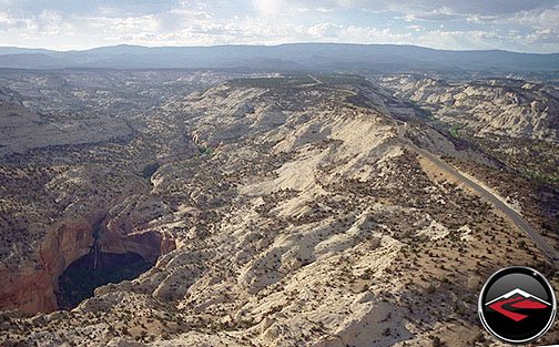
As soon as we started heading south, we started climbing in elevation. The road is pretty curvaceous, and because it’s climbing in elevation almost every turn is going uphill, making for plenty of traction and lots of acceleration. The road just flows. Before we knew it, we had gotten so high that I felt like I could have been riding in Yellowstone, not southern Utah. But the constant Utah reminder is always there – when you look out towards the east all we could see is the red rock and the miles of huge plateaus. It’s quite impressive and we just had to stop to take a look.
Once the road started going downhill again we came, almost immediately, into the town on Boulder. There used to be a great little eatery and gift shop just across the street from the Anasazi Indian Museum, but the past few times we have gone by its been closed. This is sad. We have fond memories of this place. Stopping having an ice cream shake and laying on the grass, in the shade of the huge cottonwood trees, thinking about how lucky we were to be riding motorcycles. Unfortunately, this time there were many signs that let us know that the place would not open again for business for quite some time.
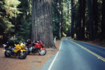
We were feeling adventurous and decided to try a new road that had just been paved. Called the Burr Trail, the new road is a hard left turn in Boulder off towards the east. The road is narrow, and not very fast, but you probably wouldn’t’ want to go too fast because of the terrain that is surrounding you. I felt like I was in the middle of a sized-down Canyonlands or Grand Canyon.
Again, we had to stop and take some photos. Eric did such a great job keeping up, riding the wheels off the little Honda, with the bigger bikes that we teased him that when he gets a bigger bike we’re not going to let him ride with us because he’ll be going way to fast. The trail straightens out after a few miles and looses the “Amazing” factor. The first third is really the best part. But we continued until in turned to gravel. At this point, all the street bikes turned around and headed for a restaurant and lunch. Danny and Loretta continued on the dirt road to see what they could see at the bottom of the next hill. Danny was feeling pretty cool about how his TDM can handle the dirt while the rest of us chose to head back until he got to the bottom of the hill and found a mini-van parked there. He didn’t feel so cool anymore and rushed back to meet up with us.
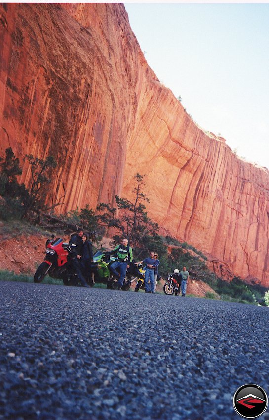
After lunch we headed towards the most famous part of Hwy 12. We have always called the next section “Devils Backbone.” That is not really the name, “Hells Backbone” is a dirt road that is near the area, but we started referring to this as “The Backbone” because of the sheer cliffs on both sides of a twisty, windey road.
I’ve never been able to go too fast through highway 12. The consequences of a mistake or the mistake of a Volvo driver would be detrimental. Besides the scenery is so amazing, it’d be a shame to waste all your energies looking at the road when what is surrounding you is so unique and impressive.
Next, the road drops down onto the side of the cliffs and the place seems strangely familiar. Then it hits you. “This is the place they filmed the Coyote and Roadrunner show!!!” Of course, the Coyote and Roadrunner show was a cartoon, but this place looks just like it! And I always find myself looking up to make sure the Coyote isn’t up there with his ACME catapult, hoping to lob a rock onto the Roadrunner, but mistakenly dropping it on us.
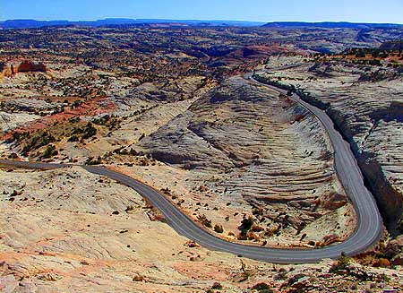
The road twists around towards the west and you come around into this. If you look closely you can see how the road works its way op the side of that mass of slickrock. If you ever see a group of motorcyclists parked on the side of the road awing over the view, stop and chat. We have bumped into motorcyclists from all over the world who come to Utah just to ride Utah’s Highway 12!
As you head towards Escalante, things get tame again, particularly after what you have just seen. Between Escalante and Henrieville, it gets almost bland, but we were still thinking about 12 and how much fun we had there. Once we got to Tropic the frequency of corners – and police officers – increased. So we slowed down and rode carefully past Ruby’s Inn and Bryce Canyon.
When 12 runs into 89, we turned south to get to Zion’s. Mark had never been to Zion’s, let alone ridden a bike through there. The best way to enjoy the park is on a bike. So we headed on down. 89 is not my favorite road. A lot of cops and a lot of cars going really fast. We did our best to be safe and were happy when we finally got to Mt. Carmel Junction where we made the turn towards Zion’s. Immediately the road gets better and the excitement over what’s coming started to flow through us. I started wondering to myself, do all National Parks smell this good? because the clean air was pronounced and seem to energize me as I rode along.
Eric had a season pass to Zion’s, so we put him in front to see if the Park Ranger would let all of us piggyback on his pass through the park saving every bike $10 dollars. The Ranger didn’t’ have a problem with it as long as we promised not to stop in the park. Fair enough! The best part about Zion’s is the ride through. We just wouldn’t be able to take any photos. While Eric put his card back into his wallet and put his helmet back on, he ended up near the end of the group. We started easing through the park looking at all the pretty rock and wondering why the road is red. Traffic was strangely light so we were able to lean through most of the corners.
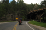
Zion’s has a series of long tunnels on the east side of the park. So we like to enter from the East side. Not only do you get to ride through the long, cool tunnels and listen to how good your bike sounds, but when you come out on the other side, the view is breathtaking. Somehow a car got in front of Danny and Eric, so as they came out of the tunnel a car started pulling off to the side of the road. Eric simply started going around him when the car suddenly decided not to stop but keep going. The Ranger parked at the mouth of the tunnel saw the whole thing and chased down Eric to give him a ticket for illegal passing.
The good thing about getting a ticket in a National Park is that it is a federal ticket. Meaning it does not go on your state driving record. The bad news is that its’ a $50 fine. We figured that since Eric’s pass had saved us all the cost of admission to the park that we would donate to the Eric Ticket Fund. Eric was reluctant, but we forced him to accept the donations by buying his dinners and campgrounds. Pretty fair, wouldn’t think?
We stopped in Virgin for dinner, and it is here that Mark got what he was hoping for the entire trip. As we came out of the restaurant, crowded with people waiting to eat, Kris noticed a bunch of little kids staring at the sport bikes and asked, like she always does, “Which one is your favorite?” In unison and without hesitation, they all yelled “The GREEN one!!!” Mark was beaming with pride that his bike finally got the attention it deserved.
We left Virgin and headed towards I-15 to make it up to Cedar City before it got much darker. It’s funny how the temperature gets so hot as you drop into Verkin. It probably jumps a good 20-degrees. We got gas and started up to Cedar City. Cedar is up in elevation and the temperature dropped progressively as we got closer.
Once we arrived in Cedar, the fact that it was Memorial day was apparent. We were lucky to find a KOA that was willing to make room for us. They rented us a Kamper Kabin for less than a campsite. We rode over and as soon as we walked in the door a wave of heat from inside just blasted us. Mark was excited to sleep someplace warm while Kris and I, Danny and Loretta decided to set up tents in front of the cabin.
We ended up staying up late, talking and joking around before tuning in for a restful nights sleep after another great day of riding!
The Trip Back Home
Day Three | 410 Miles
We woke late, sleeping in, and got a late start. Took long showers and packed up slowly, laughing and talking the entire time.
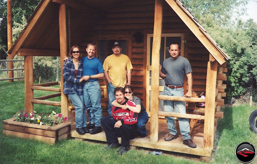
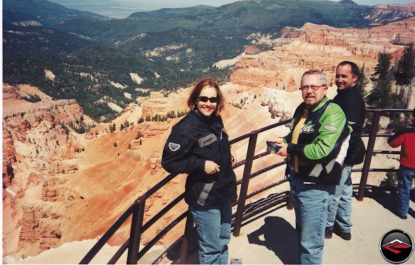
We all posed as the guy in the cabin next to us took our picture. (You may have seen this photo before) We then headed over to the neared breakfast buffet, gorged ourselves and headed for home. We took Hwy 14, a very nice canyon, out of Cedar City back into the mountains. Halfway through we turned north onto 148 and stopped again for some cool photos standing above Cedar Breaks. A miniature Bryce Canyon that you don’t have to pay a lot of money to look at.
After admiring the view we took off again, heading north towards Hwy 143, we turned east and headed down the other side of the Dixie National Forest and into the town of Panguitch. Panguitch is Native American for "Big Fish" and was also featured in the movie Contact starring Jodie Foster. If you remember, Panguitch was the town that the crazy guy that blew up the spinning machine was from. We found out that the producer of Contact got a speeding ticket in Panguitch so decided to make it the home town of a lunatic. Funny huh? From Panguitch, our only choice was north on 89. (Not my favorite road) until we made Kingston. Here we turned east onto 62. This is a remote little road that has quite a few great turns and interesting scenery. Large red-rock mushrooms seem to grow along the side of the road. But it’s only about 12 miles before it turns north and gets boring.
The road was straight and flat, so to pass the time, I started weaving across the road. (you know so my tires will wear evenly) I was in the lead and Danny was in the rear doing the same thing. Everyone in the middle thought we were being silly/stupid. Suddenly Danny was gone from behind us. So I slow.. Don’t see him… Slow some more… Still, don’t see him and decide to turn around to make sure everything is okay. This turned out to be our close call of the trip. While He was weaving about, he felt the back of the bike hop. Loretta then felt something smack her in the back of the leg. Danny immediately pulled over. This is when I made it back to him. We looked around the bike. The chain was still on, the bags were still in place. We were perplexed. (We were also perplexed that someone had taken a deer and hung it on a fence post near our chosen parking stop – Deer on a stick?) Danny decided to head back along the road to see if he noticed anything. He quickly came back with the answer.
Apparently a strap and worked its way loose and had gotten caught, briefly, in the wheel before it snapped. What Loretta had felt was the end of the strap flipping up and hitting her leg. Fortunately, no one was hurt and we were reminded of how important it is to pack wisely, placing straps in places where they won’t get caught in anything. (Incidentally, a week or so later, Mark was riding along and felt a similar hop, and because of this experience, he decided to stop and check it out. His saddlebag strap had come loose and got caught in the wheel! The hop warned him and he stopped in time. Just before the whole saddlebag setup slid into his wheel. Whew, that was close!)We got going again. We came to the town of Koosharem. We’re not sure but we think this is a huge polygamist town. We stopped for gas at the edge of town, got some Cheetos that turn your mouth blue (strange) and continued on. Hwy 62 stops at Hwy 24, where we turn right and head towards Fish Lake again, turning left back onto hwy 25. Over fish lake, back to 72. (We love 72!!) Back through Freemont Junction. (Where is this town?) and onto hwy 10. Yuk!We decided to take a quick break to talk about how much fun 72 was. It was here, on a previous trip, that I noticed a huge glob of tar on the side of the road. It was a glob of the tar the Utah Department of Transportation uses to fill cracks in the road. We hate this stuff. It snakes all over the road and makes for miserable traction and are known as "Gummy Worms."
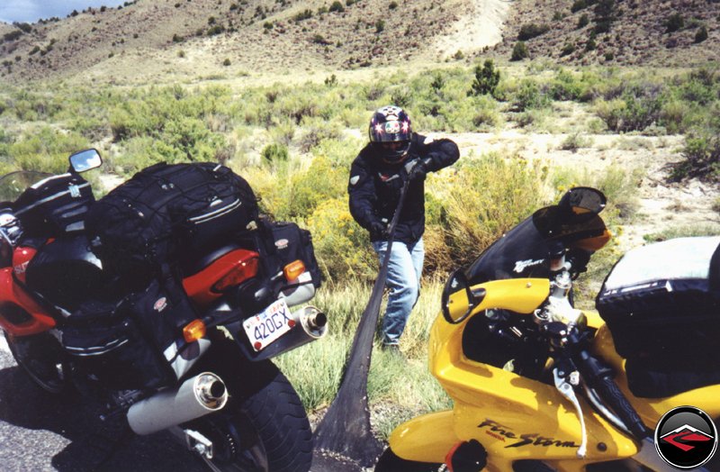
TI decided to take the glob of tar and stretch it to see how far it would go. Whaddya’ think I got there? Six feet? Pretty gross! Riding on it is even worse. We blasted up Hwy 10 to Huntington where we stopped for gas before heading back up and over to Scoffield. On the other side, we had to contend with the plethora of traffic working their way back onto the Wasatch Front, and consequently got stuck in an endless traffic jam in Price Canyon. Not fun. On the other side, just into the town of Moark Junction we peeled off and headed north on secondary roads into Provo where we stopped for the final dinner of the trip. We stopped at Cafe Rio, near the BYU stadium, where we ate the best tasting "Smothered Burritos" in the world! Very good! We laughed about our favorite jokes, told of the scariest corners we came to and teased Eric about riding the guts out of his CB550K. We all said good-bye, Mark and Eric headed for home in Layton and Salt Lake respectively. While Danny and Loretta followed us home so Loretta could catch her 10:30pm flight back to New Jersey. It was a really good trip that ended too soon. But they always end too soon. Hopefully we’ll be able to go out again. Its unfortunate that you can’t live on the road.